ECDIS in tidal ports does not behave the way it does in open water. The system was designed to do one thing above everything else: warn you before your ship enters water that is too shallow.
Every other function — route planning, position monitoring, chart display — exists in support of that purpose. The feature that delivers on it is the safety contour alarm.
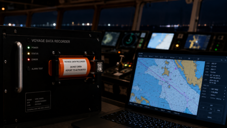
Under IMO Resolution MSC.530(106)/REV.1 — the current ECDIS performance standard — crossing the safety contour triggers a mandatory alarm, audible and visual, classified at the highest alert priority. For equipment installed before January 2026 the governing standard remains MSC.232(82), which carries the same requirement. Across both standards, the safety contour alarm is the one automatic audible alert the performance standard mandates for grounding risk.
In tidal ports, that alarm routinely stops working. Not because of equipment failure. Not because officers are cutting corners. Because of a fundamental mismatch between how ECDIS was designed and how depth behaves in a tidal environment. Understanding that mismatch — and what to do about it — is what this article is about.
How ECDIS in Tidal Ports Breaks Down
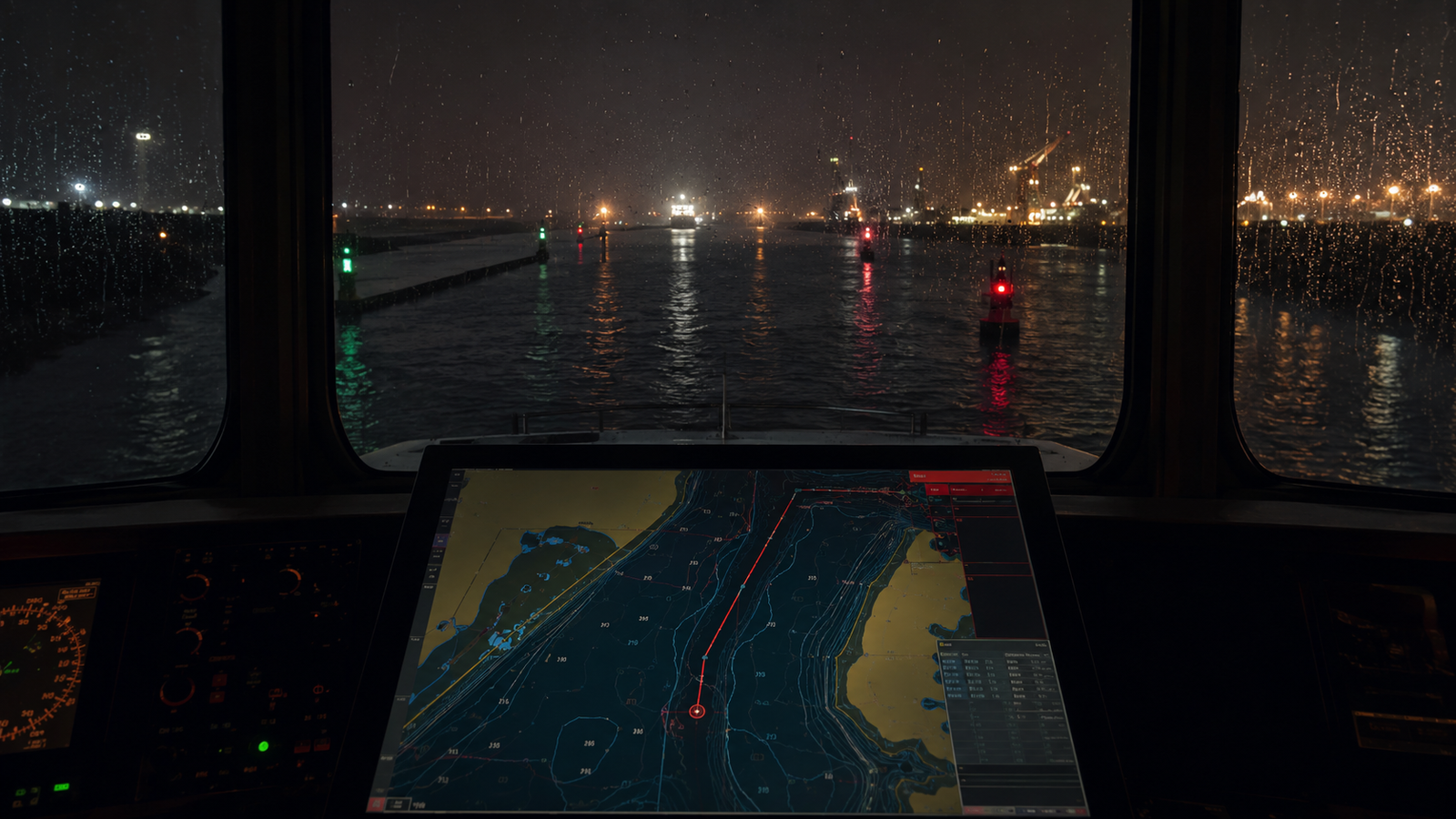
ENCs display depths referenced to chart datum — effectively the lowest astronomical tide. In deep water or low-tidal range environments, the difference between charted depth and available depth at any given moment is small enough to ignore in practice. In a tidal port with a range of several metres, they are materially different, and the gap changes throughout the approach.
The safety contour is set by the navigator based on a UKC calculation — draught, squat allowance, heel, wave response, and required minimum UKC. That calculation produces a minimum water depth the vessel needs at any point during the transit. Enter that value as the safety contour and, under MSC.530(106)/REV.1 section 11.4.3, ECDIS will give an alarm and graphical indication if the vessel will pass within a specified time or distance of water shallower than that value.
The problem is that in a tidal port approach, charted depth — the reference ECDIS uses — is frequently less than the required safety contour value, even when actual available depth at that tidal state is perfectly adequate. The ECDIS has no knowledge of the tidal state. It works against chart datum. The result is a safety contour alarm that activates continuously from the outer approaches inward.
A continuous alarm is no alarm at all. Officers acknowledge it, silence it, or accept it as background. The anti-grounding warning has been rendered meaningless at exactly the point where grounding risk is highest — shallow water, constrained channel, tidal stream, reduced sea room.
There is a compounding factor. MSC.530(106)/REV.1 section 5.8 states that if the safety contour value set by the navigator is not available as a depth contour in the ENC, the system defaults to the next deeper contour available. ENCs typically carry a limited set of depth contours — commonly 2, 5, 10, 20, 30 and 50 metres.
If no specified contour exists, the system defaults to 30 metres. A vessel with a calculated safe depth of 8 metres finds no 8-metre contour in the ENC. The system quietly defaults to 10 metres — or 30 metres if that is the first available deeper contour. An indication is provided, but in practice this default often goes unnoticed. The displayed safety contour does not reflect the value the navigator entered, and the image on screen does not reflect operational reality.
What the OCIMF framework tells us
The OCIMF Recommendations on Usage of ECDIS and Preventing Incidents (2020) structures the safety contour problem around two scenarios, and it is worth understanding both clearly.
Scenario A — an appropriate contour is available in the ENC. The navigator sets the safety contour to the value derived from the UKC calculation, that contour exists in the ENC, and the system uses it correctly. The safety contour displays as a bold isoline distinguishing safe from unsafe water. Isolated dangers shallower than the safety contour appear as magenta octagons within the safe water area. The alarm works as intended. This is how ECDIS is supposed to function, and in deep water passages with well-surveyed ENCs it generally does.
Scenario B — no appropriate contour is available. The navigator’s required safety contour value does not exist as a depth contour in the ENC. The system defaults to the next deeper contour. The displayed boundary between safe and unsafe water no longer corresponds to the vessel’s actual safe depth. This is the situation that applies in most tidal port approaches — and OCIMF is explicit that in Scenario B, the primary tool for distinguishing safe from unsafe water is not the safety contour at all. It is a manual alarmable No-Go Area drawn by the navigator.
What the manual No-Go Area is and how it works
A No-Go Area in ECDIS is a boundary drawn manually by the navigator on a user layer during passage planning. It can be configured as alarmable — meaning the look-ahead function will trigger an alert if the vessel approaches the boundary, in the same way it does when approaching the safety contour. The navigator defines the boundary based on the actual geometry of the approach: the edges of the navigable channel, the depth contours that mark the real limit of safe water for that vessel at that tidal state.
OCIMF describes two methods for implementing this in Scenario B, both of which require a manual No-Go Area. Neither is considered safe without one.
Method 1: Draw the manual alarmable No-Go line at the required safe depth and lower the safety contour setting to the next available contour below that value. The advantage is reduced alarm fatigue — the vessel navigates in area the system classifies as safe, and the No-Go line provides the precise alarm boundary. The disadvantage, noted by OCIMF, is that isolated danger marks between the lowered safety contour and the No-Go line may not display correctly depending on their charted depths. Navigators should verify how their specific ECDIS type handles this before adopting Method 1.
Method 2: Draw the manual alarmable No-Go line at the required safe depth and retain the original safety contour setting, which defaults to the next deeper contour. The advantage is that isolated danger marks continue to display correctly against the original safety contour setting. The disadvantage is that the safety contour alarm will sound when the look-ahead zone breaches the defaulted deeper contour — generating alerts before the vessel reaches the No-Go line and creating a risk of alarm fatigue.
Both methods have documented trade-offs. OCIMF’s position is clear: the company SMS must define the preferred method, include it in the ECDIS navigation policy, and ensure navigators understand which approach the company requires. An inspector reviewing ECDIS records — or an auditor reviewing VDR data — will be looking for evidence that a method was applied, not improvised.
For the No-Go Area to function correctly in execution, three things are non-negotiable. The layer containing the No-Go Area must be selected and displayed during route monitoring, not just at planning stage. The boundary must be configured as alarmable, not merely visible. And it must be reviewed and approved by the Master as part of the passage plan.
What ships actually do
In practice, the No-Go Area methodology is rarely applied consistently. The most common practical response to the tidal port alarm problem is to set the safety contour against the lowest expected tidal depth during the approach window — the worst-case tidal state. If tidal height will range between 1.5 metres and 3.5 metres above chart datum during the transit, the safety contour is calculated against 1.5 metres. This keeps the alarm functional throughout the approach: at any tidal state, the vessel has at least as much water as the worst-case contour assumes, so a genuine alarm means something. Precision is sacrificed but the anti-grounding function is preserved.
The alternative — leaving ECDIS in a permanently alarmed state throughout the approach — is the worst outcome. An alarm that never stops tells the bridge team nothing. It conditions them to acknowledge without investigating, and if a genuine grounding hazard appears, the warning is already lost in the background.
What this means on the bridge
For Masters and navigating officers, the practical hierarchy is straightforward.
At passage planning stage: calculate the UKC for the tidal approach, determine the minimum available depth across the approach window, and set the safety contour accordingly. If the required contour is not available in the ENC — check, do not assume — apply your company’s defined method for Scenario B. Draw the manual alarmable No-Go Area at the correct depth boundary for that approach. Ensure the layer is alarmable and will be displayed during monitoring. Have the Master approve it as part of the plan.
At execution stage: confirm the safety contour setting matches the plan before commencing the approach. Do not adjust the safety contour mid-approach without Master’s approval, and document any change. Under MSC.530(106)/REV.1 section 11.4.3, the standard requires a permanent indication to be shown whenever the safety contour alarm is deselected. If you are silencing alarms rather than managing them, that state is now visible in the system.
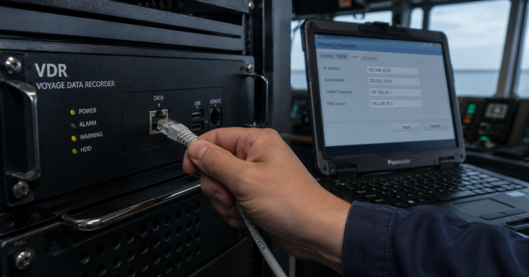
The VDR connection
This is where the regulatory development has direct operational consequence for fleet managers.
MSC.530(106)/REV.1 section 11.5.2 requires that ECDIS output safety contour settings, look-ahead parameters and route monitoring alert setting changes to the VDR at one-minute intervals. For equipment installed from January 2026 onward where the new standard applies, this data is part of the VDR record and available for remote review.
What this means in practice: a remote VDR navigational audit will show exactly what safety contour value was set at each point during a tidal approach. It will show whether the value was changed mid-approach, when it was changed, and by how much. It will show whether the safety contour alarm was deselected and for how long. It will show whether the look-ahead parameters were adjusted. The conservative worst-case tidal depth approach is perfectly defensible seamanship and will appear as such in the data. A safety contour lowered to silence a persistent alarm, with no corresponding UKC calculation to justify the value, will also appear — and will not be defensible.
For DPAs and superintendents, the implication is straightforward. The VDR data trail now includes ECDIS safety settings. A remote navigational audit that previously focused on track, speed, and bridge team actions now has visibility of the safety parameters the bridge team was actually working with. That is a significant expansion of what proactive VDR review can tell you about navigational standards across your fleet.
The structural fix under development
The workarounds described above exist because ECDIS was built around a fixed-depth model. Chart datum works adequately as a depth reference when tidal variation is small relative to available UKC. In tidal environments with significant range it does not, and the alarm architecture built on that model degrades with it.
The IHO S-100 framework addresses this at the standards level. S-104 is a new product specification for gridded water level predictions — it replaces static spot tidal predictions with dynamic tidal surfaces that integrate directly into ECDIS. When combined with S-102 bathymetric surface data and displayed on S-101 ENCs, S-104 enables the safety contour to adjust automatically against predicted actual depth at any point in the approach, not chart datum.
The UK Hydrographic Office trialled this with the Port of London Authority on the Thames. Dynamic safety contours adjusted automatically in line with tidal forecasts. Pilots could visualise actual available depth relative to the seabed in real time across different sections of the river. The safety contour became a live navigational value rather than a planning-stage approximation.
When S-104 is operational fleet-wide, the alarm works correctly in tidal approaches because the depth it is calibrated against reflects what the water is doing at that moment. The workarounds in this article become unnecessary. Until then, the conservative tidal depth approach and the manual alarmable No-Go Area — applied in accordance with your company SMS and OCIMF guidance — remain the tools available.
More from the VDR Series
→ Explore our VDR Navigational Audit Service — View Service Page
- The VDR Playback Software Is There. The Procedure That Covers It May Not Be.
- The Lookout During Port Approach Is on the Manning Matrix. The VDR Shows Whether Anyone Was Standing It.
- When Risk Becomes Routine, the Bridge Goes Quiet
- The First VDR Audit Your Fleet Runs Should Be Announced. Here’s Why.
- The Anchor Is Down. The VDR Doesn’t Know That.
- The VDR Track Shows More Than Where the Pilot Boarded
- The Radar Is Running. The VDR Shows Whether It’s Doing Its Job.