I have reviewed VDR data from vessels approaching complex port entrances where the planned route placed the ship in a higher-risk position than necessary — and where no one on the bridge had questioned it before departure.
The plan had been prepared. It had been approved. It had been loaded into the ECDIS. And then it was followed, faithfully, into a situation that a proper pre-departure appraisal would have avoided entirely.
In both cases I describe below, the execution was professional. The officers were competent. The ships arrived safely. These are among the most common passage planning mistakes ships make — errors that produce no incident, leave no trace in the voyage file, and are never corrected because nothing went wrong.
“Both ships arrived safely. That is not the same as saying the plan was right.”
The Problem Is Not the Route. It Is the Process.
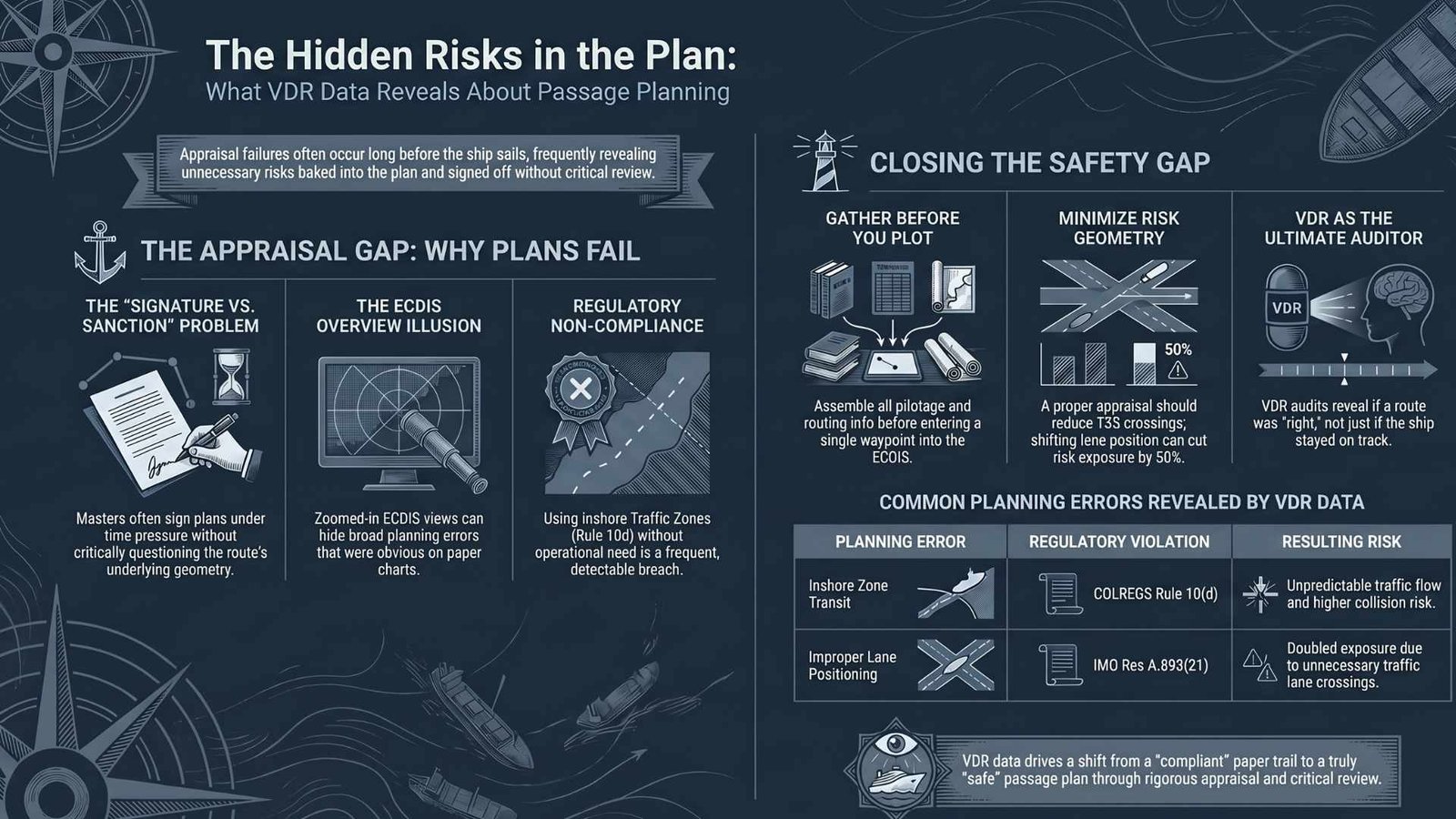
Passage planning guidance is not vague. SOLAS Chapter V, Regulation 34 requires that voyages be planned prior to departure, taking into account all pertinent information. IMO Resolution A.893(21) — the Guidelines for Voyage Planning — breaks the process into four distinct stages: appraisal, planning, execution, and monitoring.
The appraisal stage is the foundation. Section 2.1 of A.893(21) sets out what must be gathered before a plan is built. Clause 2.1.7.5 specifically requires consideration of existing ships’ routeing and reporting systems — which includes traffic separation schemes and inshore traffic zones. Clause 2.1.7.7 requires that pilotage information, including embarkation details, be assessed at this stage. The approach geometry to a pilot station is not an execution decision. It belongs at appraisal.
Section 3.4 is equally clear: each voyage or passage plan shall be approved by the Master prior to commencement of the voyage. Not initialled. Not filed. Approved — which implies the Master has understood it well enough to sanction it.
In both incidents below, the appraisal stage did not function as it should. The plans were put together, approved, and executed. The questions were never asked.
Two Incidents. The Same Failure.
Incident One: Into the Inshore Zone
The vessel was in a Traffic Separation Scheme (TSS) headed to Pilot station. The passage plan routed the ship from the main traffic lane into the adjacent inshore traffic zone, where it remained for a period before arriving at the pilot boarding position.
The inshore traffic zone is not an alternative approach corridor. COLREGS Rule 10(d) is explicit: a vessel shall not use an inshore traffic zone when she can safely use the appropriate traffic lane within the adjacent separation scheme. The zone is designated for vessels which, by reason of their draught, size, or the nature of their cargo, cannot safely navigate within the main lane. This vessel had no such limitation.
In the inshore zone, vessels may proceed in either direction. Traffic is mixed. Overtaking situations, crossing situations, and close-quarters encounters are all more likely than in a properly organised TSS where ships move in the same direction. The risk exposure is materially higher — and it was entirely avoidable.
Had the bridge team conducted a proper appraisal before departure — gathered the relevant routeing information as A.893(21) clause 2.1.7.5 requires, sat down with the chart and the port guide, and asked why the plan was routing the ship into the inshore zone — the answer would have been uncomfortable, and the plan would have been corrected. Instead, the ship entered a higher-risk environment because no one questioned a decision that should never have been made.
The VDR showed competent watchkeeping throughout the approach. The risk was not in the execution. It was in the plan that preceded it.
Incident Two: Two Crossings Instead of One
The second incident involved a different vessel again navigating in a TSS. The passage plan positioned the ship on the starboard, outer side of the traffic lane — the side furthest from the pilot station.
When the time came to proceed to the pilot boarding ground, the ship had to make not one TSS crossing but two. First, she had to cross within her own lane from the starboard side to the port side. Then she had to cross the opposing traffic lane to reach the pilot station. Two crossings, two periods of elevated risk, two windows where she was cutting across the flow of traffic.
Had the Second Officer positioned the ship on the port side of the lane during the approach — which the prevailing traffic flow would have supported — only one crossing would have been required: through the opposing lane to the pilot. The risk was cut in half. It would have cost nothing to achieve.
COLREGS Rule 10(c) is clear that vessels crossing a traffic lane shall do so on a heading as nearly as practicable at right angles to the general direction of traffic flow. Every crossing is a period of elevated exposure. Minimising the number of crossings is not merely good seamanship — it is the logical output of a properly conducted appraisal. In this case, the appraisal either did not happen or did not reach this question.
This was not a navigation error during the approach. It was a planning error that made the approach unnecessarily complex — and it was never caught.
Why Does This Happen?
The passage planning process, as it functions on many vessels, has separated into two activities that rarely connect.
The Second Officer prepares the plan. The Master approves it — sometimes in name only. He signs it, or initials it, often under time pressure, often without sitting down and reading it critically from beginning to end. The plan is then filed as a document and loaded into the ECDIS, and the execution phase begins.
A.893(21) section 3.4 requires that the Master approve the plan prior to commencement of the voyage. That approval is an act of professional judgement — and judgement requires understanding the plan well enough to question it. Which means reviewing it in enough detail to understand where the ship will be, at what time, in relation to what traffic, and why.
In both incidents above, that review did not happen with sufficient rigour. No one asked why the inshore zone. No one asked why the ship was on the wrong side of the lane for the approach. The plans were executed, the risks materialised to a lesser degree than they might have, and the vessel moved on to the next port.
The planning failure did not produce an incident. It just produced an approach that was harder and more exposed than it needed to be. The gap between a signed plan and a reviewed plan is where most passage planning mistakes ships make actually originate. And because nothing went wrong, the lesson was never learned.
The Chart Table That Disappeared
There is a generational dimension to this that is worth naming.
In the era of paper charts, a passage plan was a physical object. The Master would open the chart — sometimes several charts, laid out in sequence — and the entire passage was visible at once. The coast, the traffic lanes, the anchorages, the dangers, the pilot boarding positions. It was all there, at a glance, drawn in pencil by the Second Officer. Corrections were easy. Annotations were common. Distances were measured with dividers. Notes were written in the margins. The Master who looked at that chart understood instinctively where the ship was going and why.
ECDIS changed that dynamic in ways that are still not fully appreciated. A passage on ECDIS is experienced as a sequence of zoomed views — one section at a time, on a screen. Getting a proper overview of the full approach requires deliberate effort: zooming out, panning, switching between chart scales. It is not the same as unfolding a paper chart and seeing the whole picture. Many Masters — and I include myself in this observation — find it harder to engage critically with a plan on ECDIS than with a plan drawn on paper.
The result, on many vessels, is that ECDIS planning has become the exclusive domain of the Second Officer. He is the one who knows the system, who builds the route, who runs the checks. The Master approves what he is shown, often on the same screen, often at the same scale the Second Officer was working at — which may be zoomed close enough to verify waypoints but not wide enough to see whether the overall approach geometry makes sense.
The ECDIS route check is a capable tool. It will flag depth contour violations, proximity to charted dangers, and speed inconsistencies. It is genuinely useful and has caught real hazards. OCIMF’s own incident analysis — in their 2020 publication Recommendations on Usage of ECDIS and Preventing Incidents — identifies overreliance on ECDIS during the appraisal stage as a recurring contributing factor in navigational incidents, alongside failure to properly consult sailing directions and other available information. The technology is not the problem. How crews engage with it is.
The ECDIS can tell you if the route is safe. It cannot tell you if the route is right. Only someone other than the person who planned it can do that.
The paper chart forced a physical encounter with the passage. A Master who opened the chart and looked at it had, almost by default, reviewed the plan. ECDIS does not force that encounter. It requires it to be deliberately sought — and on too many vessels, it is not.
What SIRE 2.0 Inspectors Will Find
SIRE 2.0 is specifically designed to surface the passage planning mistakes ships make that documentary evidence alone cannot reveal. Inspectors are not simply checking whether a plan exists — they are evaluating the quality of the thinking behind it.
Was the appraisal conducted?
Inspectors look for evidence that routeing systems, local regulations, and pilotage information were gathered and considered before the plan was built A filed plan is not evidence of appraisal.
Is the TSS routeing COLREGS-compliant?
Route plans are checked against Rule 10. An inshore zone transit without operational justification is a direct observation. There is no grey area.
Did the Master genuinely review it?
Section 3.4 of A.893(21) requires Master approval before commencement. Inspectors probe whether the Master can speak to the plan — the route choices, the crossing points, the reasoning. If he cannot, the approval was nominal.
The uncomfortable reality is that if the plan was approved and filed, the documentary evidence may look entirely correct. It is only when an auditor traces the actual route against the regulatory requirements that the failure becomes visible.
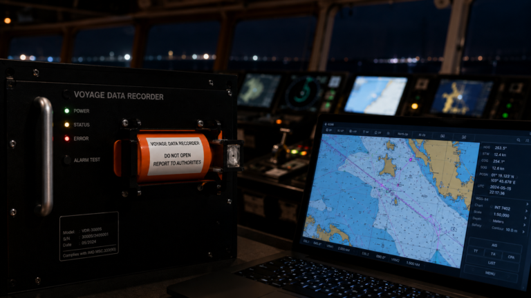
What the VDR Shows That the Paper Trail Does Not
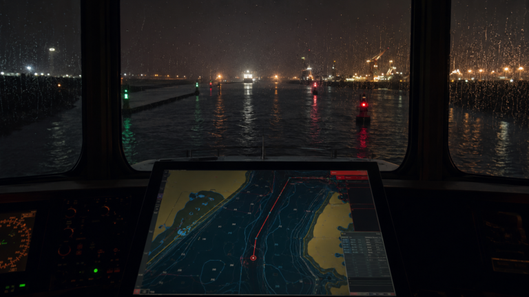
The VDR records the actual track of the vessel. It records the ECDIS display, the chart in use, the planned route, and the position of the ship relative to that plan — every moment of the approach, without observer bias and without preparation.
A VDR-based navigational audit does not just review whether the ship followed the planned track. It reviews whether the plan itself was sound — whether the TSS routeing was COLREGS-compliant, whether the approach geometry minimised crossing risk, whether there is evidence that the Master engaged meaningfully with the planning process before the ship sailed.
These are things that cannot be seen in the voyage file alone. A correctly filed, correctly signed passage plan tells you that the process was followed. It does not tell you whether the route was right.
The VDR tells you where the ship actually went, and whether it should have been there.
What Good Passage Planning Appraisal Looks Like
The appraisal stage is not paperwork. It is a conversation — and it happens before the ship sails, at the chart table, with time to think.
01
Gather before you plan
Sailing directions, port guide, pilot information, routeing guides — all consulted before a single waypoint is entered. As A.893(21) section 2.1 requires, the full picture assembled before the route is drawn.
02
Challenge the geometry
Which lane, which side, how many crossings, at what angle. Every decision justified before departure, not discovered on arrival. Minimise crossings. Stay in the main lane unless there is a reason not to.
03
The Master owns it
Not a signature. An understanding. The Master should be able to explain every route choice — because if he cannot explain it, section 3.4 of A.893(21) has not been met, and the approval was a formality.
These questions take thirty minutes. They require a chart, the relevant publications, and a willingness to challenge the plan before it becomes the plan. They would have caught both failures described in this article before the ship left port.
The appraisal stage exists for this reason. It is the moment when errors are cheap to fix. Once the ship is moving, they are not.
Final Thought
Both incidents I have described involved competent officers and professional watchkeeping. Neither produced an incident. But both placed the ship in a position of unnecessary risk — risk that was created at the planning table and carried silently through the voyage until the approach began.
The passage plan is not a formality — and the passage planning mistakes ships make at the appraisal stage are rarely visible until an auditor traces the actual route. When the appraisal has not asked the right questions, the ship follows the wrong route. And the VDR records every moment of it.
That is the passage planning failure that VDR audits are positioned to find: not the execution error, but the planning gap that made a harder, more exposed approach inevitable.
→ Explore our VDR Navigational Audit Service — View Service Page
VDR Navigational Audits: What They Are, Why They Matter, and When to Do One
How a VDR Navigational Audit Works — A Step-by-Step Guide for Ship Managers
The First VDR Audit Your Fleet Runs Should Be Announced. Here’s Why.
When VDR Data Works For You, Not Against You
The Anchor Is Down. The VDR Doesn’t Know That.
The Port Approach Is Already on Film. Most Managers Don’t Know It.
The Master Pilot Exchange: What the VDR Hears, and What Most Ships Leave Unsaid